Custom Mapping Solutions from Digital Wisdom
Click here for a custom map quote
Special Custom Map Products
 Afghanistan
Iraq
Hawaiian Islands
Israel Afghanistan
Iraq
Hawaiian Islands
Israel
|
Style A
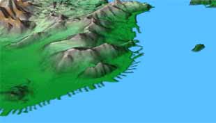
Terrain visualization using our 3D map rendering software - we can create local, county, state, national or international views, real or abstract, with numerous lighting effects. This example shows the San Francisco waterfront and Alcatraz viewed from over Oakland - we used 30 meter resolution data and exaggerated the relief by a factor of 4 to create this view.
|
|
Style B
Using our award winning Mountain High Maps we can create custom maps for print and web to your specifications. This partial view presents a European Airline Flight Route Map for Lufthansa. You will find Mountain High Maps in many airline in-flight magazines - see our Customer Showcase.
|
|
Style C
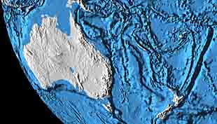
Using worldwide 1,000 meters DEM elevation data, and 10,000 meter ocean floor data, Digital Wisdom can generate high resolution terrain imagery in 2D or in a 3D view (as in this example) for use in print, exhibit walls, web or multimedia use. Coloration can be customized to a wide number of palettes, lighting adjusted to any angle, and additional geo-political information can be overlaid.
|
|
Style D
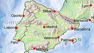
Using either pre-colored maps or images from GlobeShots, EarthShots, CoolMaps, or custom designed maps derived from the Mountain High Maps collection. Create maps for your web site which serve to show business locations or service areas, for web navigation or for general reference, we can add hot clickable areas such as demonstrated in the Digital Wisdom Reseller Network map.
|
|
Style E
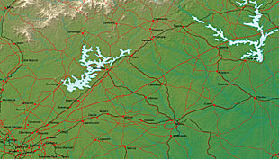
Within the USA, using 100 meters DEM data, Digital Wisdom can generate high resolution terrain imagery in 2D (as in this example) or in a 3D view for use in print, exhibit walls, web use or multimedia. Coloration can be customized to a wide number of palettes, lighting adjusted to any angle, additional geo-political information can be overlaid.
|
|
Style F
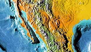
Customized views around the world featuring shadow relief maps with or without ocean floor relief as this example of the Baja California, Mexico and through to the Gulf of Mexico illustrates. Various color schemes are available along with optional geo-political national and provincial borders, rivers and towns overlays either in Photoshop layers or as corresponding layered vector artwork supplied with the bitmap relief image.
|
|
Style G
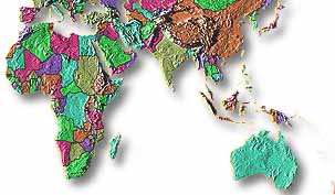
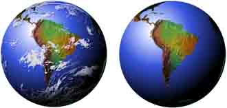
To portray the global importance of your message, Digital Wisdom presents the Earth from space from many different angles, and unlike complex satellite imagery, these images are clear and dramatic, ideal for graphic presentations. Available with or without clouds and with many optional star filled backgrounds.
|
|
Style H
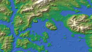
Imaginary landscapes to your specification can be generated for use in fiction, science fiction and games. 2D and 3D landforms can be created with vivid land and sea-floor relief, using a wide range of color palettes to recreate any fictionalized scenario!
|
|
Style M
USA high resolution terrain imagery for use in print, exhibit walls, web use or multimedia. Coloration can be customized to a wide number of palettes, lighting adjusted to any angle, additional multi-layered and editable geo-political information can be overlaid.
|
|
Style P
Worldwide high resolution terrain imagery which can be generated in a wide range of coloration palettes, lighting adjusted to any angle, additional multi-layered and editable geo-political information can be overlaid. For use in print, exhibit walls, web use or multimedia.
|
|
Style Q
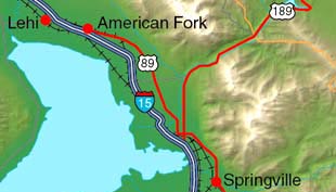
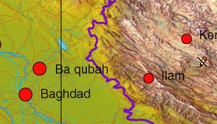
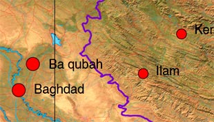
Worldwide high resolution satellite imagery with additional multi-layered and editable geo-political information overlaid for use in print, exhibit walls, web use or multimedia - many displays were custom made for television studio use during the Afghanistan and Iraq campaigns.
|
|
Style R
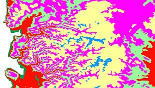
Contour maps with selective elevation banding that may be used to identify elevation ranges for technical, cartographic or scientific purposes - the color palettes used to delineate levels can be easily customized as well as the range of heights - the example shows the coast of Oregon state.
|
Click here for a custom map quote

Any comments or problems with this
site? Please
let us know
- thank you!
© Digital Wisdom, Inc.
|
